

Most visitors to Manitoulin Island are familiar with the Cup and Saucer Trail as well as the iconic Bridal Veil Falls system of steps and paths. But there are almost two dozen recognized trails spread throughout the width and breadth of the world’s largest freshwater island!
Note: As you’re travelling throughout the region, please make sure you’re following all COVID-related safety protocols; wash your hands frequently, keep physically distant and wear a mask. Read more here.
The Nimkees Trail
Toward the northwest part of the Island near Sheshegwaning, the somewhat remote, 14-kilometre Nimkees Trail, begins at the Nishin Eco Lodge on Cunningham’s Bay Road. The start of the trail is marked and well gravelled (or stone edged) for the first couple of kilometres through forested stands of hardwood.
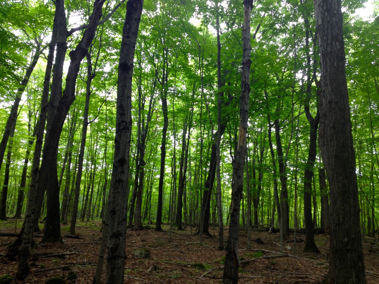
As Manitoulin Island is the northernmost point of the Niagara Escarpment, the terrain and foliage aren’t the traditional boreal forest much of the north is known for. Rather, it’s limestone cliffs; maple, oak and elm trees are interspersed with birch, pine and white cedar. After an easy trek through the light filtered forest, you will reach the shingle beach near Cunningham Point where you get your first spectacular view of the North Channel. As you look down at the stony beach you can easily pick out fossils of creatures that lived here eons ago.

Cunningham Point
At this point, the trail becomes a bit tougher as you switchback up a well-marked ridge. At the top, enjoy the upland area with breathtaking vistas of Cunningham Point to the west, and the various islands and headlands to the east. The trail then becomes level as it leads through what looks like abandoned farmland, golden with timothy and wild hay on one side of the trail, and the beauty and scent of sun-warmed Manitoulin cedar at the cliff’s edge.
As we hiked along, we found what was left of an old wooden Eagle Totem Pole on the trailside, and as fate would have it, we also came across an eagle feather, which is sacred to the local Anishnabe People. In keeping with their ways, we took the feather carefully, spread a bit of tobacco in its place, and gave thanks to the Great Manitou for the gift.
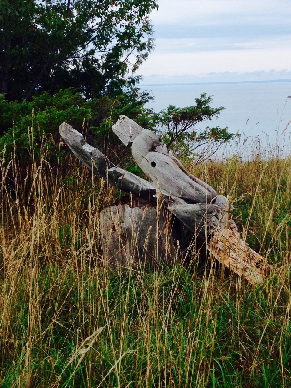
Eagle Totem Pole.
Trusting we were in the good graces of Manitou, we then continued on our way, as the trail took us downhill to Cape Roberts Road, which is little more than a one-lane bush road. At this point our party decided to go back the way we had come, rather than follow the track back to Cunningham’s Bay Road and the Lodge.
As the water level is so high this year we were unable to access the shore trail, but we were able to see sunken outcrops and wave-washed boulders from the heights. Coming upon another scenic vantage point, we had our lunch at one of the welcome picnic tables placed along the route. At no point did we come across a single soul…but driving back to Sheshegwaning, we did see a young bear run into the woods, sit and gawk at us in his best Winnie the Pooh pose, rump to the ground, and a look of curiosity on its face.
M’Chigeeng Trail
For hikers who want more of a challenge, the shorter but much steeper 5-kilometre M’Chigeeng Trail offers not only a good workout but an up-close and personal look at the wind turbines and the M’Chigeeng marker. This sign, in the best Hollywood tradition, can be seen for miles away and is a great photo spot.

The trail itself starts at the backside of the Francis Xavier Community Ballpark, just past the village of M’Chigeeng (formerly called West Bay) and travels up a mostly gravel lane leading to the top of the hill that overlooks the village, Lake Mindemoya, and West Bay. Soon the lane turns into a wooded trail that takes you past scenic points right to the cliff’s edge. The view is spectacular all year long, but the colours of autumn are breathtaking as you gaze down from the heights. It is a perfect picnic place, sans table, and you can add a bit of glam to your day posing in front of the gigantic letters that make up the sign.
In years past, the trail was accessed by 800 stairs, leading from level to level, but times being what they are, the stairs have been removed and newer trails put in their stead. This trail is also a one way in one way out affair, so take the time to enjoy the colours and fall wildflowers along the way.
Are you hiking on Manitoulin Island this weekend? Share your photos with us on social media using #neontario!

